
August-
September 2021
Living Lessons
------------------
|
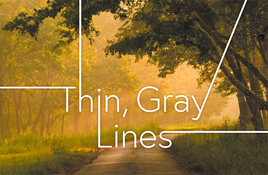


Thin, Gray Lines
By Brenda Evans
A map is “a testimony of man’s faith in other men… A map says to you, ‘Read me carefully… without me, you are alone and lost’”—a few of Beryl Markham’s words in her memoir West With the Night. As a bush pilot from 1931-1936, Markham ought to know about maps. Flying a mostly wood and fabric airplane, she banked on maps while ferrying mail, supplies, and people into Kenya, Sudan, and Tanzania.
I won’t quibble with Beryl that maps are essential, nor disagree we are putting our faith in men and their technology. My husband Bill and I set great store in maps. We like them—both our iPhone maps and huge two by three feet paper ones with crazy lines and numbers everywhere, those annoying ones that defy my attempt to neatly refold.
I do quibble with Markham’s assumption that if you read a map carefully, you won’t get lost. Maps can fail you miserably. Just last month, the blue line on my iPhone led us every way except the right way. We stopped three times. (Who says a man won’t stop and ask?) Finally, a young mechanic with greasy hair and hands rolled out from under his car and gave us good directions. We made the wedding on time.
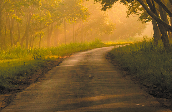
Another failure was more miserable. The map was paper. We left a meeting in the mountains at 11:00 a.m. to take a scenic route home. According to the map, the usual five-hour trip would become a six-hour jaunt. We’d still be home long before dark. Our paper map showed a red interstate for a while, then a narrower red U. S. highway, followed by a black state road, several thin gray lines of numbered county roads, and finally another red line to take us home. Since I was driving the first leg, Bill plotted the route on a notepad, laid the pad next to me, and reclined his seat to take a quick nap.
I whizzed along. Two red roads, the black, and finally the first thin gray line. No problem, though the gray line certainly was curvier than the map showed, with steep hills and cracked asphalt here and there. On the second gray line, I drove deeper into a dull brown and sunless woods. Not surprising. It was early March, no greening yet. But only a rare house was a surprise. Third gray line—I stopped, undecided. Bill’s note indicated a right turn onto 699. There was a right turn, but no numbered sign. He roused. We checked, stayed straight, and watched for 699.
Miles later, we still found no 699 sign and only left turns. Our thin gray line had become gravel, with deep potholes and patches of broken asphalt. Cracked and dried mud and scrubby grass edged the road, which soon narrowed from two lanes to one. No cell service, no vehicles, no utility lines, no houses. Several times I hit a bad pothole with a heavy thump.
“You’re going to knock off a wheel,” Bill warned.
“I can’t see them ‘til I hit them,” I muttered back. “Why don’t you drive?”
“You’re okay. Keep going.”
“Where are we?” I whined.
Bill checked the paper map again and didn’t answer.
A shadow of fear began to grow. Our map had failed us, and the same for our cell service. When we left at 11:00 a.m., we planned to go mostly north and slightly east for five or six hours and be home. Three devices still worked: gas gauge, wristwatch, and the car’s compass. Our gauge showed half full (good); my watch said 4:00 p.m. (we should have been almost home); but our compass was swinging every direction except steadily north. Lord, show us a path.
About 5:00 p.m., we saw a slim thread of blue smoke above the trees, then a tin roof and one-story house set back 50 feet from the dirt road. An attached garage held a bold warning sign in red and black: DANGER BEWARE. A yellow rope tied to slender stakes looped around the yard. On the left side a large black dog waited.
“Blow the horn,” Bill said, eyeing the dog and the open front door. Finally, a man appeared, standing mostly inside. Bill eased closer to the yellow rope. The dog lay still but ready.
“Sir, I think we’re lost,” Bill said.
“Imagine you are,” the man answered without a smile, keeping his right arm inside the house—on a shotgun, I assumed.
“We’re looking for Highway 699.”
“Never heard of it.”
“What about a main road that goes north?”
“Down there about five miles,” the man bobbed in the direction we were headed. “Cross a bridge; turn left. Stay on that.”
“Thank you, sir.”
Back in the car, Bill stated the obvious: “He didn’t want company.”
“You see a shotgun?” I asked.
“Nope! Let’s go.”
Fifteen miles later, still no bridge, no house, no left turn, no main road—but a green creek joined us on our left, tumbling over rocks in the direction we were driving, like a trickle of hope. Bill disagreed.
“No, Babe, this is a Deliverance movie. Wild woods, green creek, no human beings. Meanness. The bad guys are coming. Just haven’t shown up yet.”
Finally, we came to an elbow junction. Our choices? Go back (unthinkable) or bear left with the creek. We followed the creek. Our compass lit up: SW. Southwest! The direction we didn’t want to go. Home is north and a little east, I reminded the compass. The road improved slightly, less gravel. Across the creek, scattered remnants of a railroad track lay rusting in undergrowth, then a broken-down coal or gravel tipple, vine-swathed and long unused. Lord, show us a path.
Twilight, 6:30 p.m. The road straightened for a hundred yards, and we saw a building—white with a red roof, two pick-up trucks, and four human beings: men working on a third truck in a red-roofed garage. A small home set against the hillside 50 yards up. One of the men called off three growling dogs and met Bill halfway with directions: Straight ahead, then right, then left, and in the small town do a hard right. That would lead us to a red line on our map so we could find our way home.
Thank you, Lord, for human beings who smiled, held no shotguns, read “lost” in our eyes, and told us a way.
We plunged on. The creek turned away from us, but the wild woods remained. Gradually, here a house, there a house. Then the little town’s four-way junction and our hard right turn. Dusk was closing in. Twenty miles further, orange cones and a barricade appeared without warning: Flood water. Road closed. I gave the wheel to Bill. He backed, spun in mud, maneuvered more, and pointed our nose back to the four-way junction and due north on our compass. In pitch-black night, we took whatever turns we could to stay mostly north, and finally bumbled into a red numbered road. At the hotel, my watch rolled to 9:30 p.m. Finally, after ten hours, we were “unlost.”
These days, we laugh about those long hours on the thin gray lines, but not at what we learned. We are wiser about whose map we follow. Thin gray lines aren’t always what they seem to be, whether in the Appalachians, the Rockies, or in life. Roadblocks and spinning in the mud? Turn around; do a 180?. Spiritually, it means repent and start over.
As for compasses, a good one has at least 32 points, but all have four: N, E, S, W. On most, four ordinals fall halfway between: NE, SE, SW, NW. Along with more refined points. True north may point to the geographic North Pole, but not all roads run true north. You can count on that.
My true True North is not found on a compass. It is a fixed point in the wild woods and spinning world: my faith, values, prayers, scriptural principles, and God’s precious promises. And when I’m lost on life’s thin gray lines, True North is always my guide home.
About the Writer: When she finds her way home,
Brenda Evans lives in Ashland, Kentucky. Contact her: beejayevans@windstream.net.
|
|